Remote Sensing

ERT began its Federal government contracting support in the field of satellite remote sensing. We have strong expertise in conducting remote sensing research and applications in biospheric, atmospheric, oceanographic, and geophysical sciences. Our experience includes Earth and weather satellite remote sensing and airborne remote sensing algorithm development, data processing, and product generation.
- Algorithm Development: We develop scientific algorithms using satellite and airborne remote sensing data and in-situ data to generate atmospheric, climate, vegetation, coastal, and geophysical products.
- Calibration and Validation: Our staff characterize, calibrate, and validate satellite instruments onboard NOAA (including JPSS and GOES-R, -S instruments) and NASA Earth observation satellites.
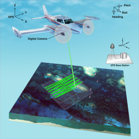
- Airborne Remote Sensing: ERT plans and conducts airborne surveying and mapping activities; installs equipment on airplanes and performs maintenance and repair; and collects, processes, and analyzes airborne remote sensing data.
- Data Processing and Product Generation: We operate, maintain, and sustain satellite and airborne remote sensing data processing and product generation, including NOAA GOES -13, -14, -15, JPSS, and GOES-R, and airborne Lidar data.
